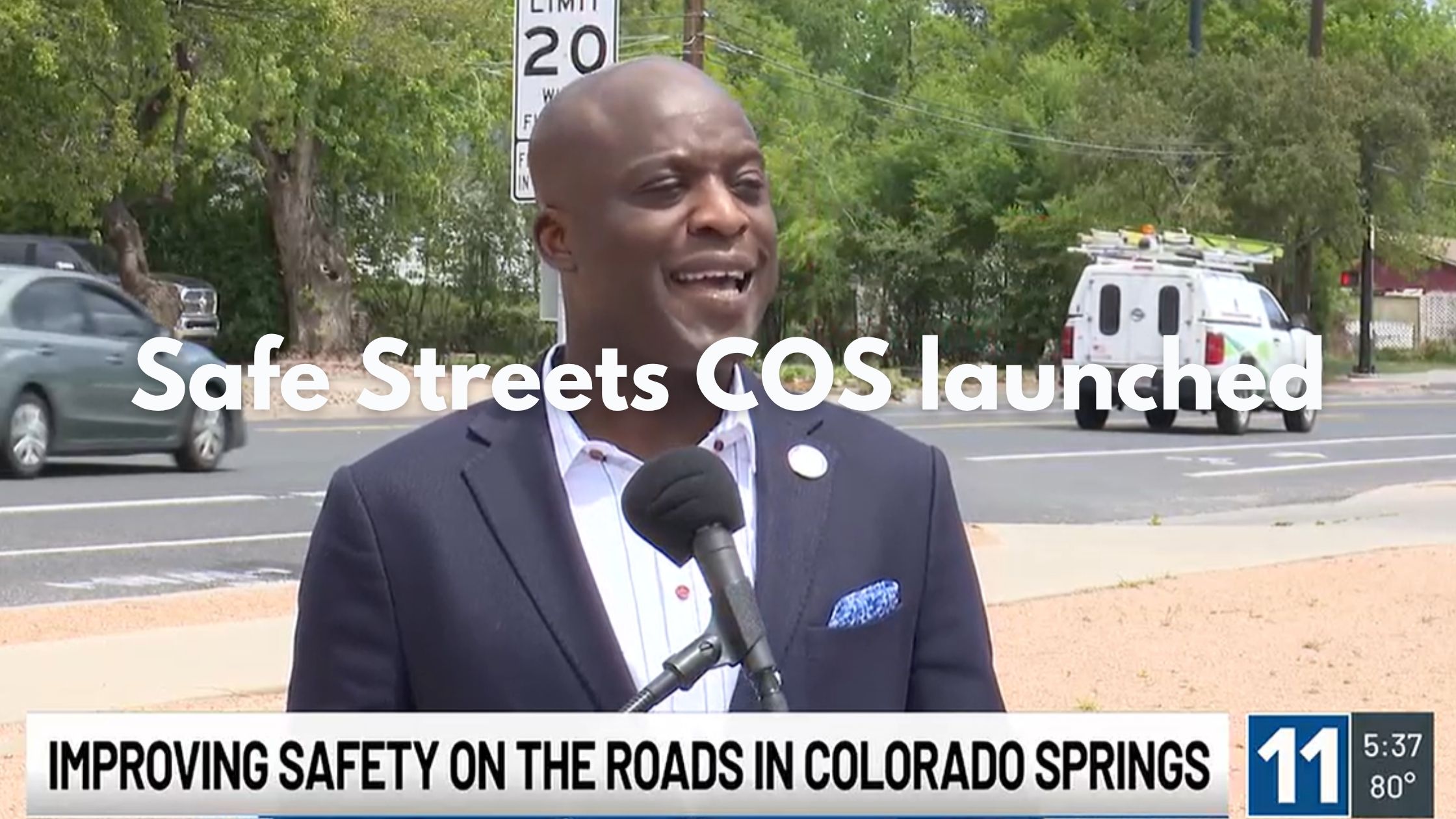
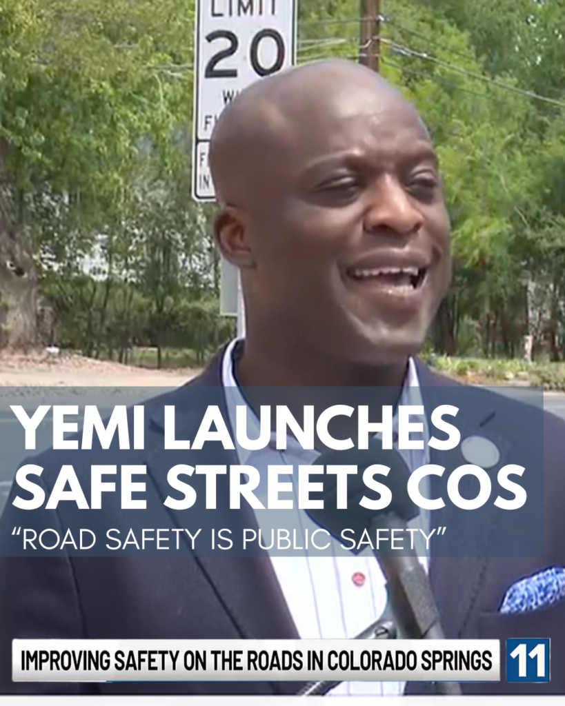
Safe Streets COS: Mayor Yemi Commits to a Safer, More Connected City
Last Wednesday Mayor Yemi officially kicked off the Safe Street COS initiative signaling a heartening shift in our city’s approach to transportation and transportation safety citywide – KKTV Article (header image from this reporting) Declaring, “Road safety is public safety”, the mayor has committed to protecting lives on our roadways through smarter data and safer infrastructure.
This builds on the city’s Transportation Safety Action Plan which was officially adopted by the Colorado Springs City Council this month (See the Bike COS safety action plan call to action here)
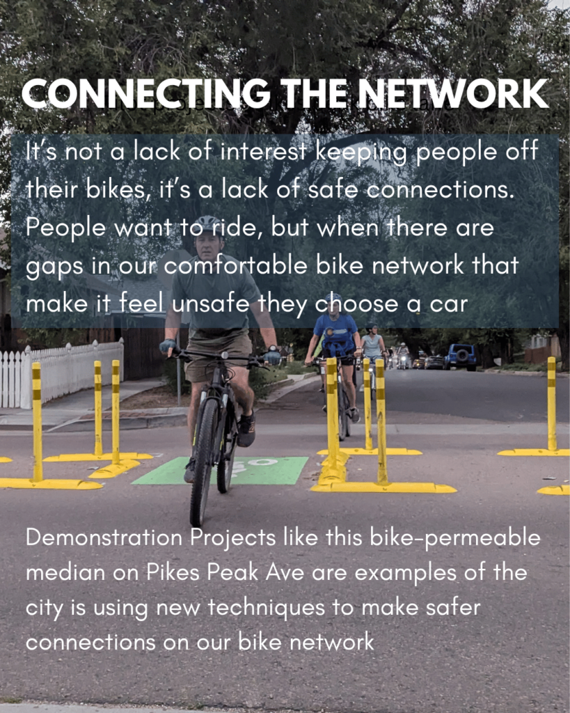
This all comes back to our mission of Making bicycling in the Pikes Peak Region better for people of all ages and abilities. Nationally, the single biggest factor keeping people off their bikes isn’t a lack of interest, it’s a lack of safe connections. People want to ride, but when there are gaps in our comfortable bike network that make it feel unsafe they choose a car instead (See the 2025 Study on Infrastructure Roadblocks).
1. Bridging the Gaps
Connectivity is at the core of what makes a city bikeable. Safe Streets COS focuses on “high-risk corridors” and trail crossings to ensure our network isn’t just a collection of paths, but a continuous, safe system. By treating these unsafe connections as a public safety priority, the city is clearing the path for more residents to choose a bike for daily trips or recreation.
Safety Demonstration Projects (Implemented & Planned):
- Neighborhood traffic circles: To calm intersections in residential areas.
- Speed tables & Speed feedback signs: Proven tools to reduce speeding.
- Protected bike lanes: Physical separation to provide safe connections even on higher traffic streets.
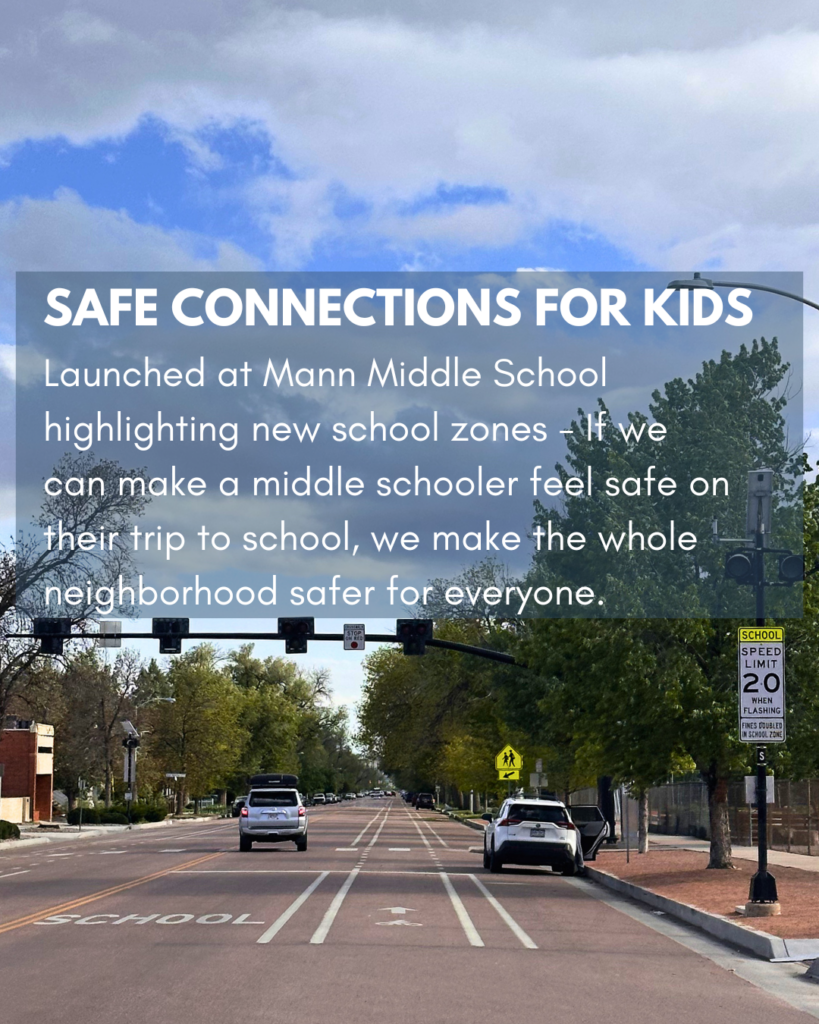
2. Building Safe Connections for Kids
The launch at Mann Middle highlighted our most vulnerable residents, our children, with a focus on school zones. By using engineering to slow speeding drivers, the city is making the connections our city’s kids use to walk and bike to class, the safe environments they should be. If we can make a middle schooler feel safe on their commute, we make the whole neighborhood safer for everyone.
Link to Planned School Zone List
3. Data-Driven Transparency
You can’t fix what you can’t see. As part of the city’s safety action plan, the city launched the Safe Streets Dashboard, an interactive tool that lets you explore crash trends in your own neighborhood. Making this data easily accessible allows us to see exactly where those unsafe connections are so we can advocate for the improvements needed to make all our residents safe.
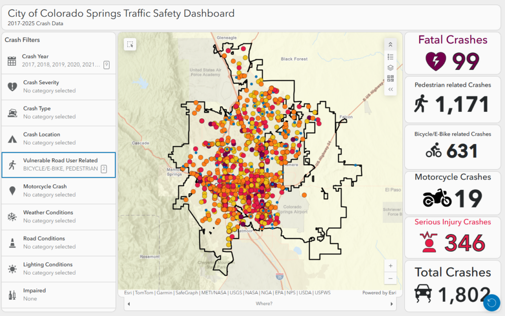
The Goal: A 35% reduction in serious injury and fatal crashes by 2035. Explore the Data: ColoradoSprings.gov/SafeStreetsCOS